
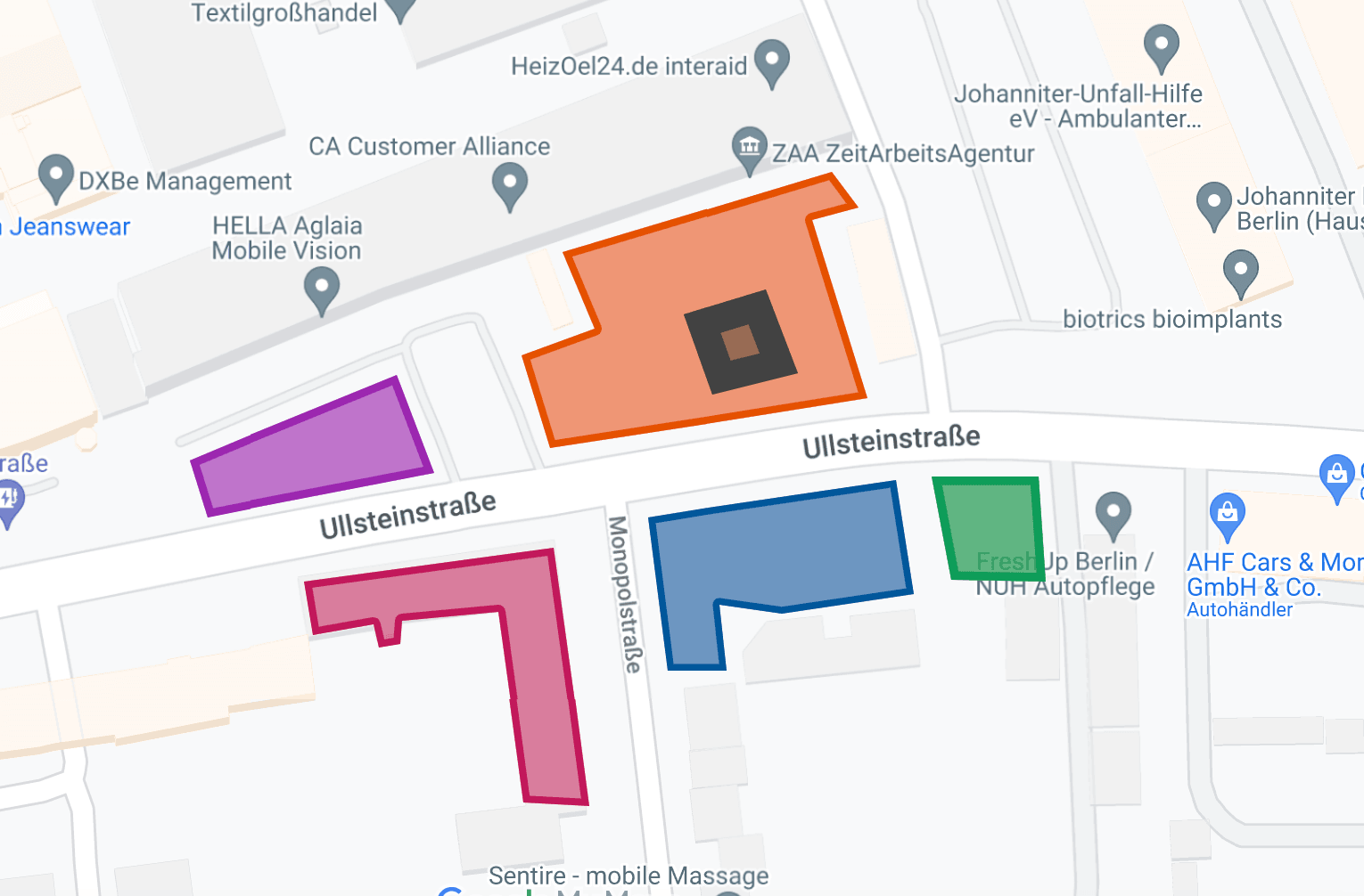
Most people know Google Maps will measure the distance between two points. Fewer know it will also measure the area of a shape you draw — a lot, a roof, a section of sidewalk, a field.
There are four ways to do it, and which one you want depends on whether you need the number once or need to keep it:
- Measure area on the computer with Google Maps
- Measure several areas, save and edit them, with Google My Maps
- Measure area on your phone with Google Earth
- Measure distance on your phone with Google Maps
Measure area on the computer
The fastest way to get square footage out of a piece of ground is plain Google Maps.
- Zoom in on the property you want to measure.
- Right-click on it.
- Choose Measure distance.
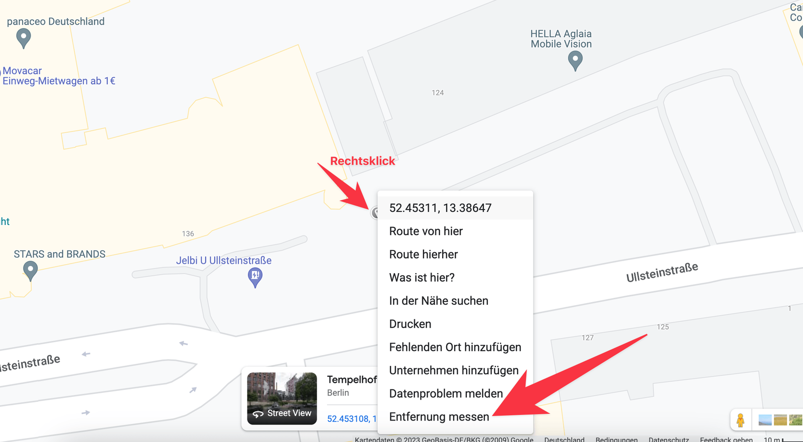
A black dot appears. Now left-click your way around the edge of the area. When the shape is closed — click back on the first dot you placed — the area appears along with the perimeter.
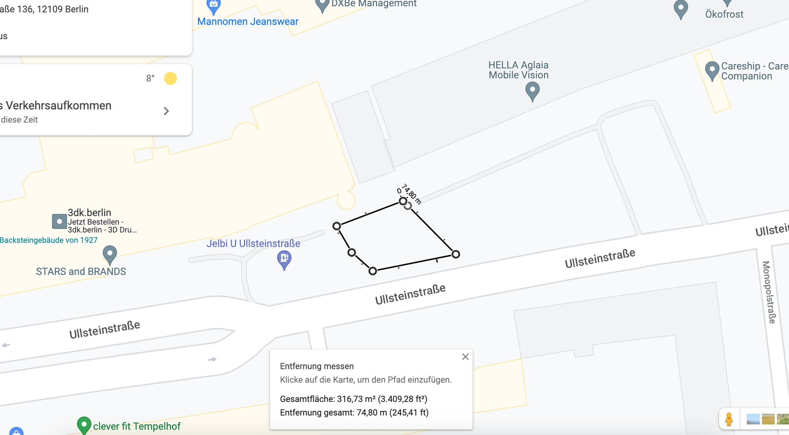
You can adjust afterward by dragging the corners, adding points or removing them.
Google shows the result in square feet and, above a certain size, in acres as well. If you need square meters or hectares instead, the units follow your Google account's region setting rather than anything you can change per measurement.
This method is good for a quick number. If you need to measure several areas, see them at once, and keep the work, use the next one.
Measure several areas and save them
To measure more than one property — side by side or stacked — use Google My Maps. Compared with plain Google Maps you get:
- several areas measured at the same time
- names, colors, notes and photos on each one
- maps and layers that save to your account
- anything you draw can be shared with someone else
Here is how:
- Zoom in on the property you want to measure.
- Click the polygon icon.
- Choose Add line or shape.
- Start clicking the outline with the left mouse button.
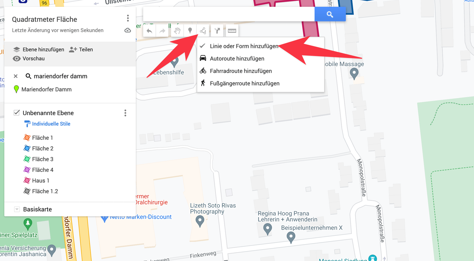
Close the shape by clicking the point you started from, then hit Save. The shape, its color, its name and its description can all be changed later.
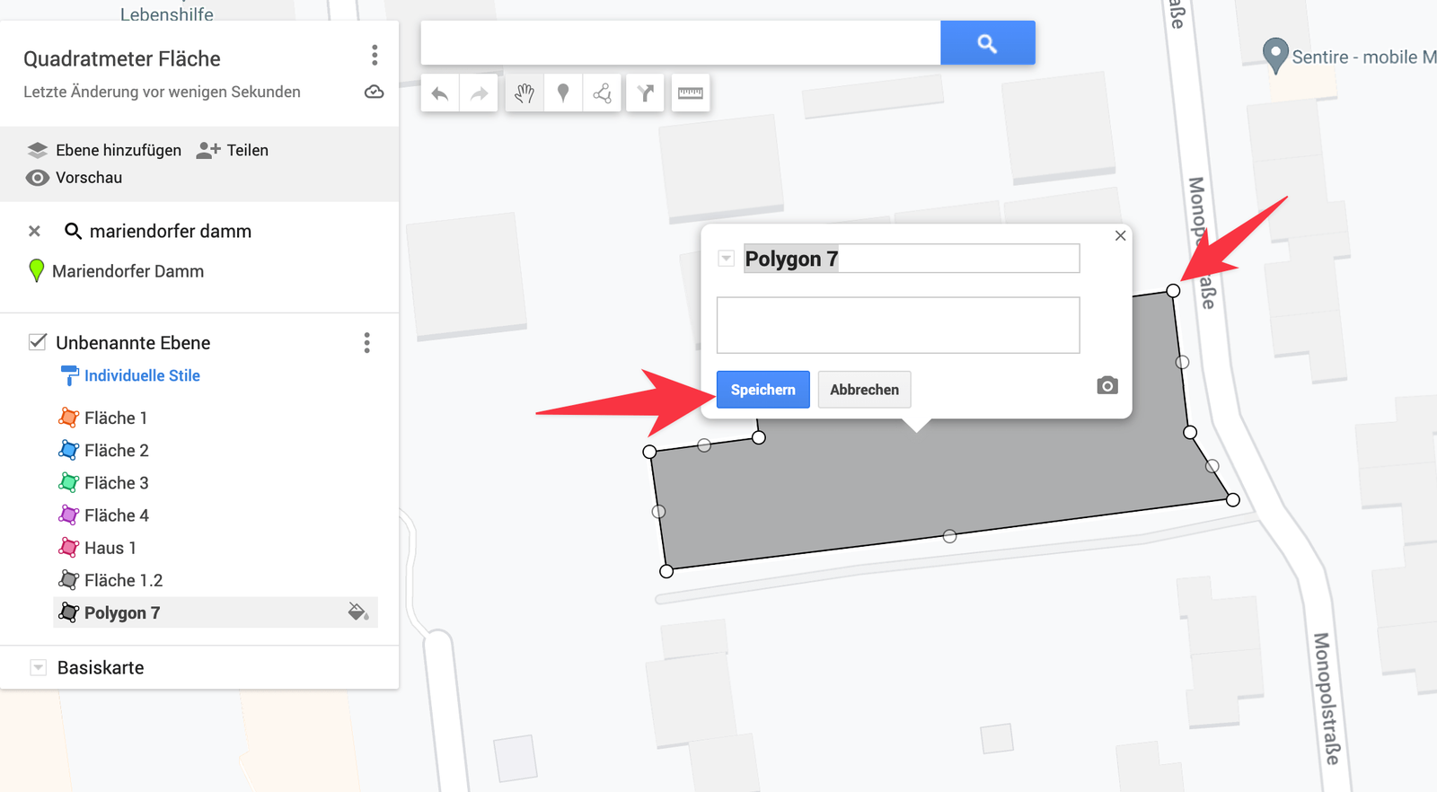
The area shows in a window above the shape when you click it.
Draw as many as you like. If you hit a limit, add a new layer to the map — Add layer at the top left.
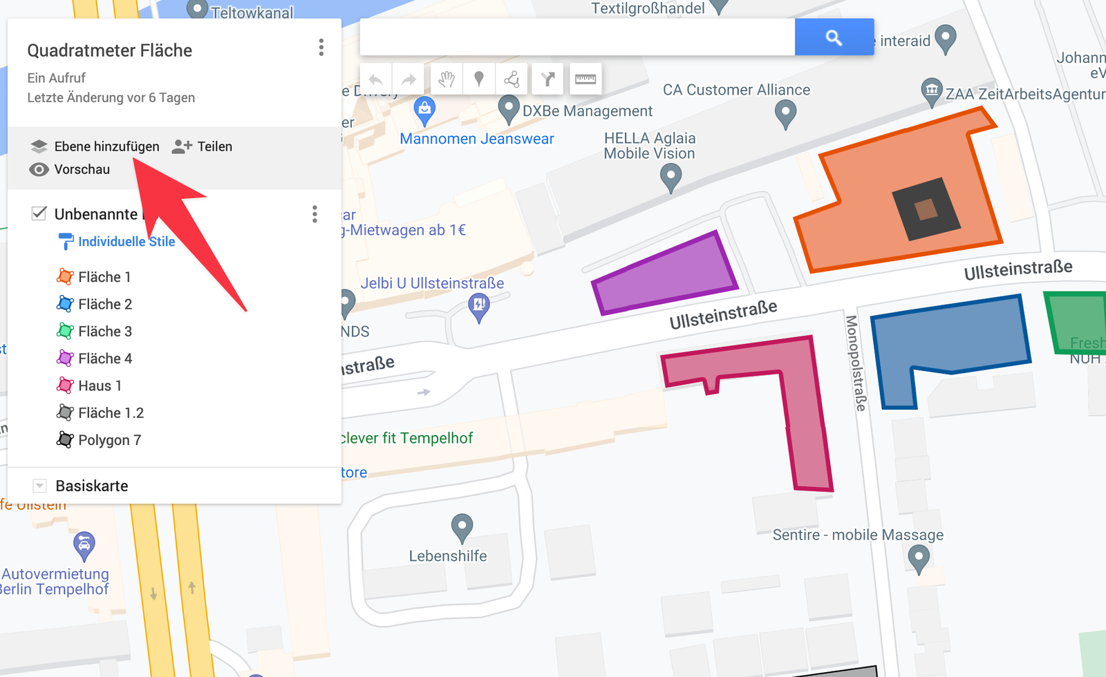
My Maps is only slightly more work than plain Maps and gives you far more in return. Your work saves itself, which is why it is almost always the better choice when area is something you will need again.
Measure area on your phone
To measure a property from your phone you need the Google Earth app. Once it is installed:
- Tap the ruler icon at the top of the screen.
- Drop your first point on the map.
- Drag the map to the next corner and drop another.
- When you get back to the first point, tap Done.
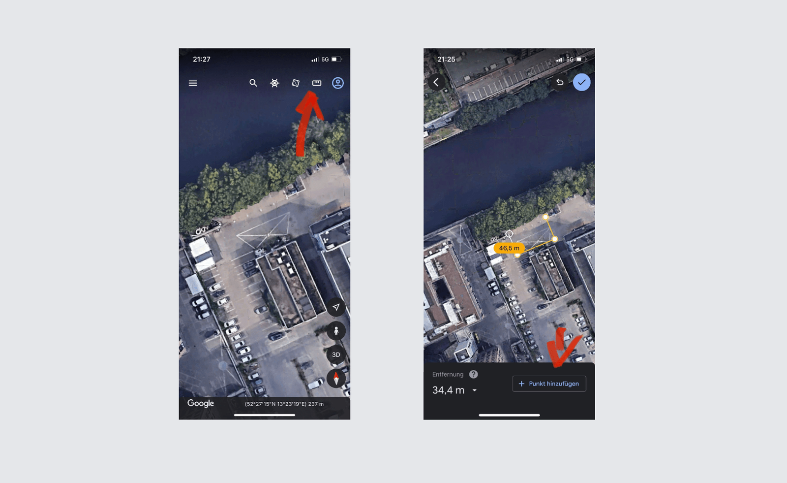
Area and perimeter appear immediately and can be copied with one tap.
Measure distance on your phone
If you are out on site and only need the distance between two or more points — not the area — the regular Google Maps app does it. You almost certainly have it already:
- Zoom in where you want to measure.
- Press and hold your finger on the first point.
- In the panel that slides up, tap Measure distance.
- Add as many points as you need.
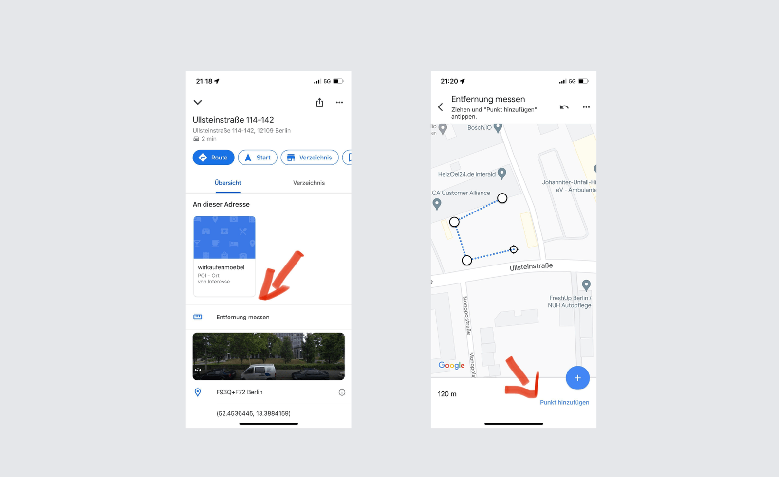
The running total shows at the bottom of the screen.
When the map is no longer the tool
Measuring is one thing; doing something with the measurements is another. Once you are measuring the same properties every season, assigning them to crews, and having to prove the work was done, a map is the wrong place to keep that.
That is the point where a route planner does the job better. Besides area, Google My Maps can also plan routes with many stops and import GPX files — but when your stops, notes, photos and proof all need to live in one place, try xRouten instead.
Try xRouten free for 14 days
Try it now