
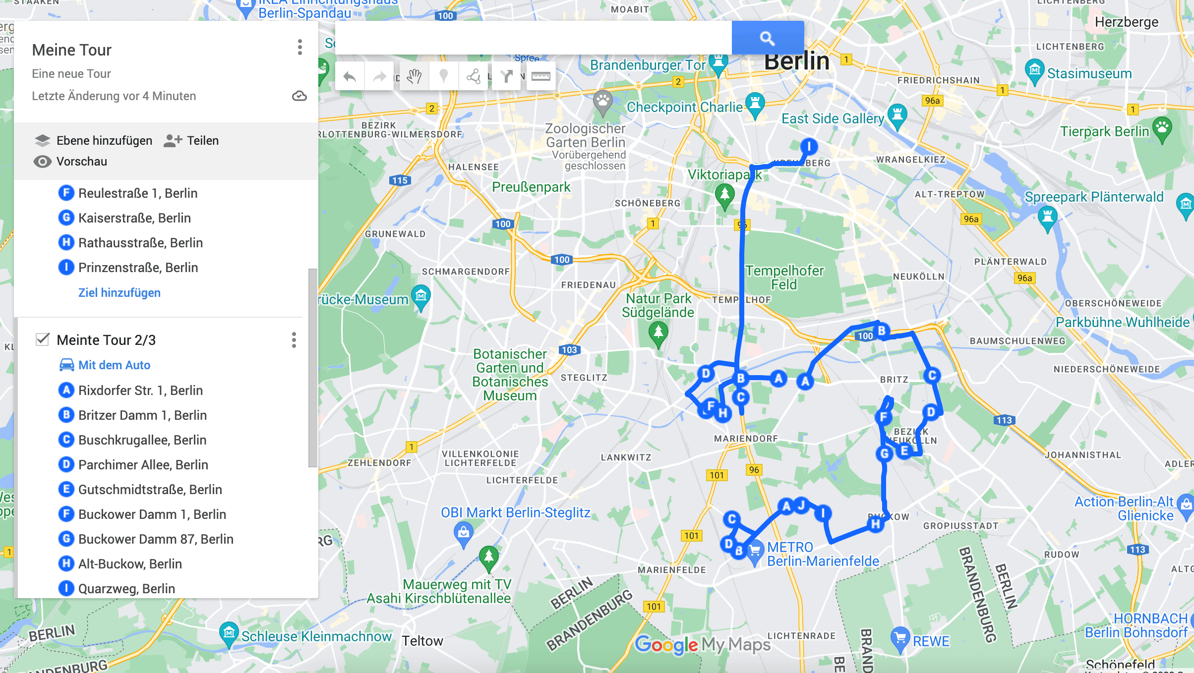
Google Maps caps a route at 10 stops. If you have 30 deliveries, that cap is the first wall you hit — and the workaround is not the app you are already using.
Use Google My Maps instead. It is a free Google tool that most people have never opened, and it gives you far more room to work than regular Google Maps does. You will find it at mymaps.google.com.
This post covers how to use Google My Maps to:
- Build routes with more than 10 stops
- Show a lot of addresses or coordinates without a route
- Save your routes and maps and share them
You need a Google account. If you do not have one, you can create a free one the first time you open the page.
Build routes with more than 10 stops
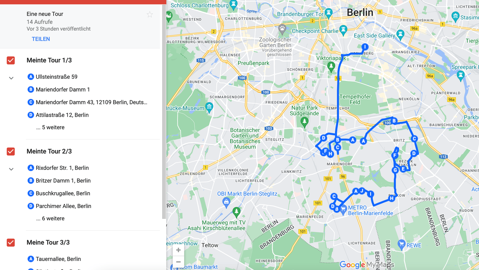
At first glance it looks like My Maps also caps you at 10. You can get around that by splitting the route into parts, which is how you end up with routes of 100 addresses. Here is how:
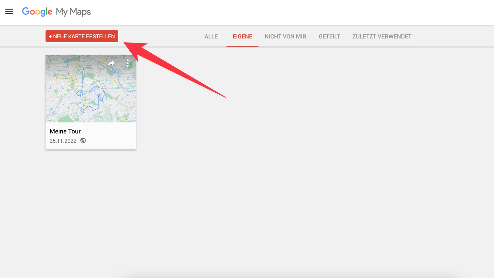
- Click the red Create a new map button at the top left. The good thing about Google My Maps is that every route and map you build stays in your account.
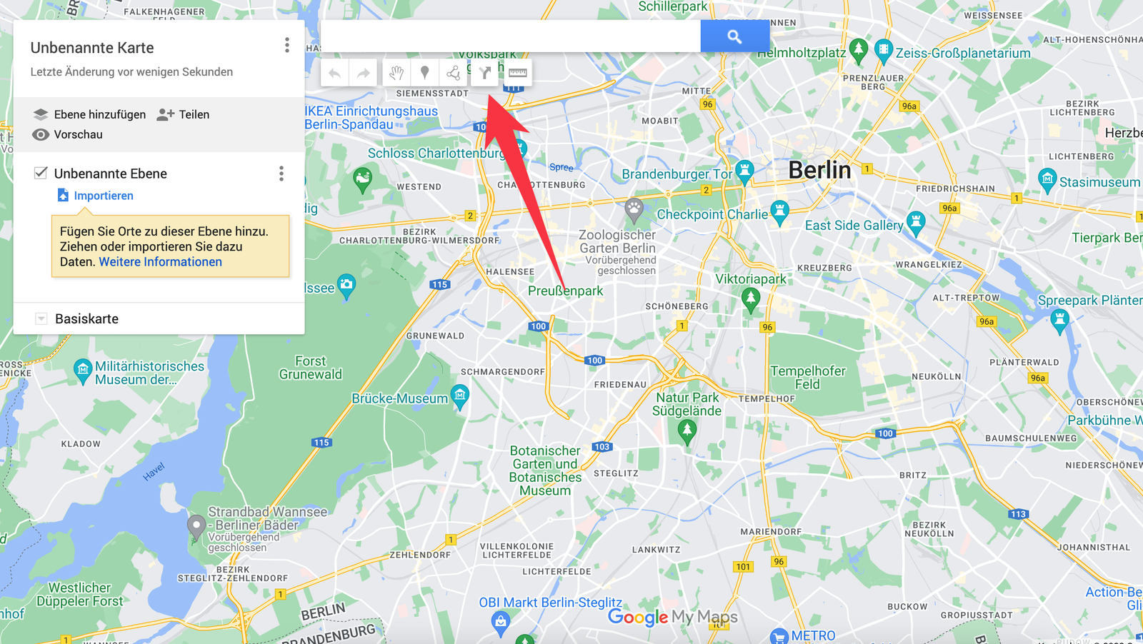
- Everything in My Maps is organized in layers. In our case each layer is a leg of the route. Click the arrow icon under the search bar to add a new layer with a route in it.
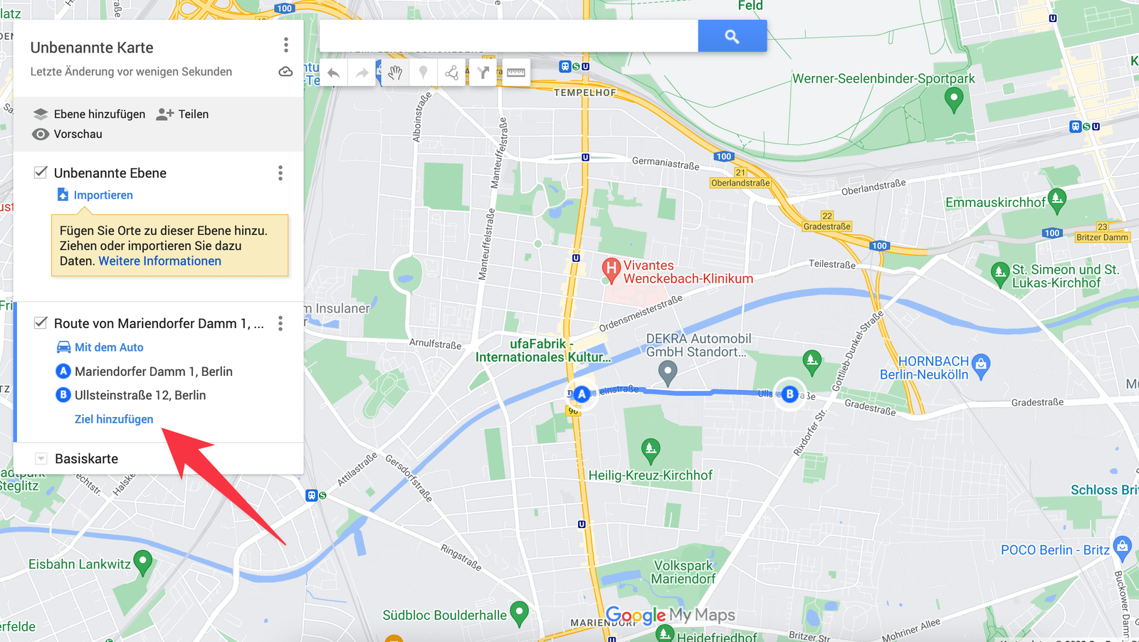
- Now add addresses, either by clicking on the map or by typing them into Add destination in the list on the left. Put up to 10 addresses in, then click the arrow icon at the top again. That creates a new layer, which takes another 10 addresses. Repeat as often as you like.
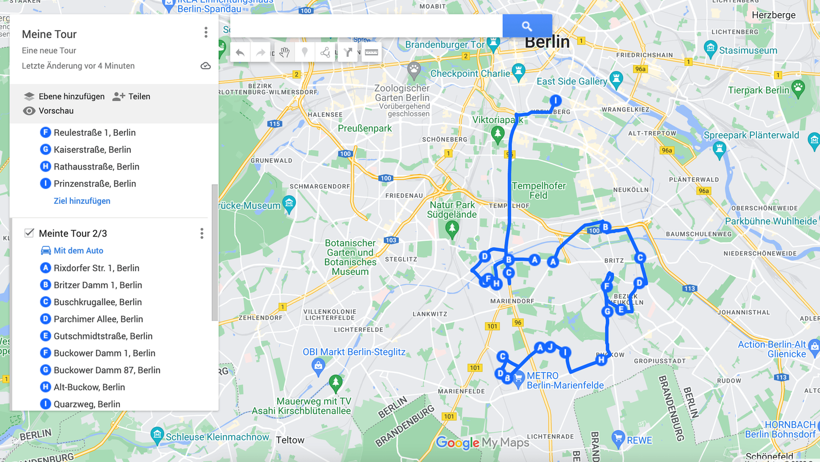
Worth being clear about what this does and does not give you: the stops are split across layers, and each layer is routed on its own. Nothing optimizes the order across the whole set, and nothing tells you whether leg three should really have come first.
Show a lot of addresses without a route
If you do not need a route and just want a lot of points — addresses or coordinates — on one map, My Maps does that too.
Drop points by clicking the map
Under the search bar there is a marker icon. Click it and you can place a point anywhere on the map with the mouse and write extra information into it.
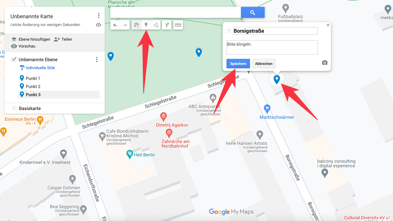
You can edit that information later and attach photos and notes to it. Just click the point on the map again.
Import addresses and coordinates
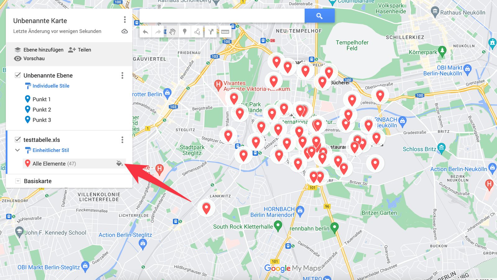
If your addresses or coordinates are already in a spreadsheet, import them. Click Import in the new layer.
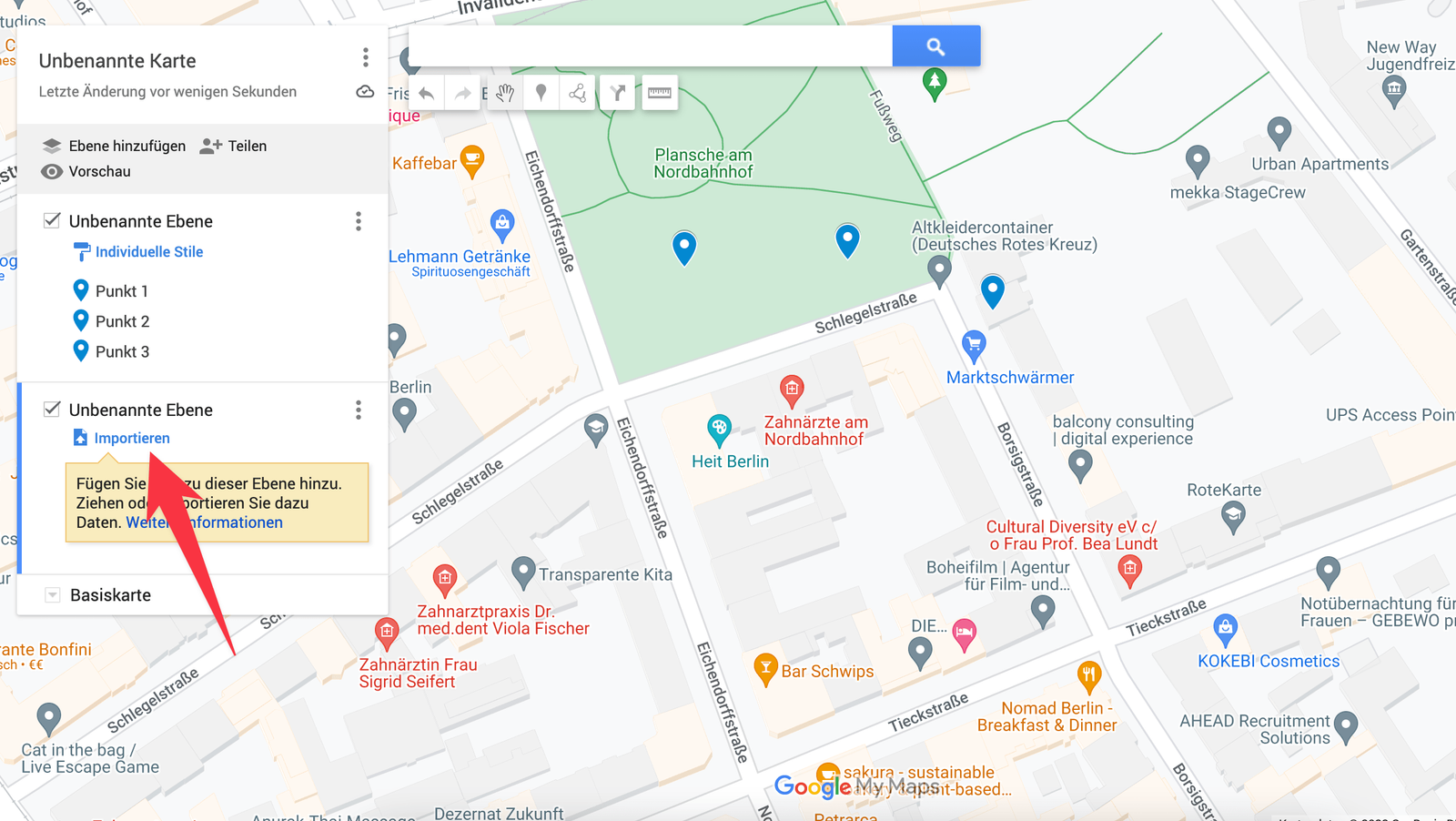
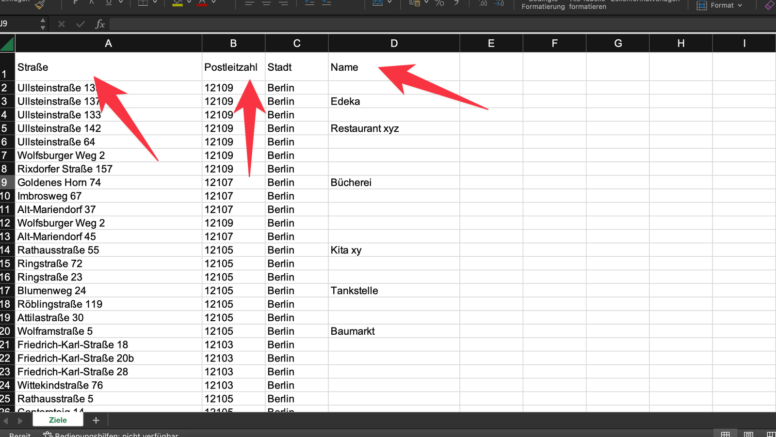
A window opens where you pick the spreadsheet you prepared. It needs either streets — with a ZIP code or a city — or latitude and longitude ("Lat" and "Lng"). Other columns like names, labels or notes come across as well.
After the import your points are on the map, and you can color them however you need from the layer panel on the left.
Save and share routes and maps
Every new map you create in Google My Maps saves to your account and can be opened and edited any time at mymaps.google.com. A couple of clicks gives you a link to a single map that you can share with anyone and open on a phone.
It works the same whether you built a route or a map full of addresses. Click Share in the layer list at the top left and decide in the next window who should have access. Copy the link you see there and send it by email, text or anything else.
People with the link can view the map but not change it.
When Google My Maps is not enough anymore
For smaller routes this is genuinely useful. If you plan a lot, and often, My Maps will start costing you more time than it saves. The problems show up fast:
- every route has to be built by hand, one at a time, and that takes a while
- changes take just as long
- no route optimization, so miles, time and fuel go to waste
- the mobile view is very limited
- no way to document that a stop was actually completed
If that is where you are, a real route planner with multiple stops is the answer — one that does this automatically:
- route planning and optimization across all your stops at once
- a clean mobile app for the drive, with navigation built in
- automatic proof of service, including photos and signatures
- live tracking while the route is being driven
Try xRouten free for 14 days and get several hours a day back from planning and paperwork.

Try xRouten free for 14 days
Try it now